DCC website

Where am I?  DCC > ALDERLEY EDGE > PHOTO GALLERY > GALLERY - PROJECTS

VIEW GALLERY

Projects
The DCC has carried out a large number of projects over the years ranging from excavating blocked shafts and levels to photography and surveying. As time has gone on, the amount of digging has decreased and studying the mines is gradually taking over.

click the picture to enlarge it, click the title to see detail

Sub-headings

    Archaeology in the mines
    Surveying the mines


Archaeology in the mines
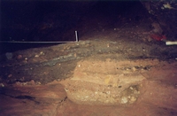
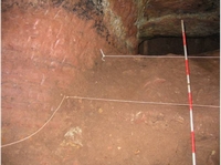
Working in Saddlebole Mine recording a cleaned surfaceThe excavated section in Saddlebole mineWork on the surface at Pot Shaft. Doug is sifting material excavated from the shaft.Timbers found at the base of Pot Shaft during the excavation. Carbon dating put them as having been part of a living tree in about 75BC.Excavation in progress in Tom's Shaft
Sketch made during Tom's Shaft excavation    

Surveying the mines
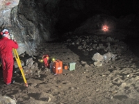
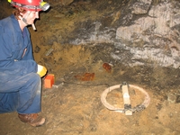
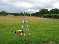
High grade surveying with a theodolite in West MineAdding detail such as passage height and width. The tape represents the line surveyed by theodoliteUsing a total station to survey in the main chamber of Alderley Edge. The distant light is a reflector placed over a survey stationUsing a total station on the surface to set up a giro on the base line at West Mine. The giro was used underground to set a base line thereThe underground transmitter for radio location. The point is found on the surface when the signal is lost - the null point.
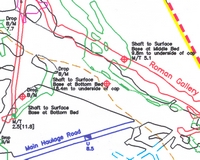
Using radiolocation on the surface to locate a signal transmitted from below groundReflector set up on radiolocated station (marked by the stake). The surveyor in the distance is using a total station to locate the station accuratelyPart of the West Mine survey with passage outlines and locations of shafts. The colours represent different depths. The red and yellow lines are significant surface boundaries.  
Using radiolocation on the surface to locate a signal transmitted from below groundReflector set up on radiolocated station (marked by the stake). The surveyor in the distance is using a total station to locate the station accuratelyPart of the West Mine survey with passage outlines and locations of shafts. The colours represent different depths. The red and yellow lines are significant surface boundaries.