Where am I? DCC > ALDERLEY EDGE > MINES > COBALT MINE
THE COBALT MINE
CONTENTS
History -o- Description -o- Access -o- Photographs -o- Map -o- Links

HISTORY
The origins of the Cobalt Mine are believed to have been in the early 19th century. The mine was apparently forgotten by the miners in the late 19th century as it is not shown on their abandonment plan but as cobalt has been found in the veins in the mine, and cobalt was apparently unknown at Alderley Edge before about 1808, we believe that this mine dates from the work by the Company of men from Stockport between 1804 - 1810. Exploration at several points on the Edge suggests that the cobalt is concentrated on a north-south series of faults as similar ores are found at Saddlebole, the Cobalt Mine, crossing the Macclesfield Road near Bradford Lane and in Finlow Wood. In 1811, the findings were rare and interesting enough to be described in magazines such as the Gentleman's Magazine where an article by R Bakewell can be found. The life of the cobalt working was however short as mainland European sources soon became available again after the end of the Napoleonic war. By the 1850s, one of the shafts had been covered by a building and the mine appears to have been forgotten.
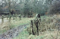
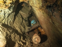
At the end of its life, one section of the Cobalt Mine found a new use as a water source for The Wizard. Water was pumped from a shaft that drops through the hanging wall, across the vein and into the footwall of the mine. The well is still marked by a pump wheel and some of the pumping apparatus is still present underground.
The DCC first entered the mine by dropping down the well and through a narrow connection into the main working. Initially, we called it the Wizard's Well Mine but it soon got the name of Cobalt Mine when the mineralisation was found to be cobaltian.
In March 2021, a shaft appeared in a field near the known extent of the Cobalt Mine and this was excavated by Club members and revealed another set of workings nearly doubling the length of the mine and eventually proving to be connected with the 'old' section. The find aroused considerable interest with the National Trust and a press release was issued in July 2022. Some 3D laser scan 'fly-throughs' can be accessed from another page on this site although as these are dependent on an external website, the long term availability of these cannot be guaranteed.
Go to TOP
DESCRIPTION
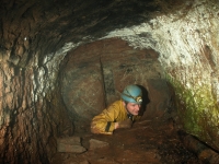
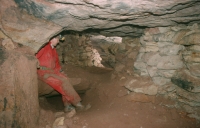
There are currently five accessible entrances to the Cobalt Mine: (1) the old well adjacent to the Wizard car park, (2) the shaft inside the mining museum (known as Tom's Shaft), (3) a shaft opposite the Wizard Tea Rooms, (4) a shaft in trees south of the Wizard Restaurant known as Holly Shaft and (5) a shaft in the field across the road. All five are connected underground by a compact mine formed on a N-S fault at several shallow levels. There are signs of there having been several shaft entrances at 10-20m intervals. The mine forms part of a series of unconnected shallow workings from Saddlebole in the north to Finlow Wood in the south, all believed to have been worked for cobalt in the early 19th century. Graffiti in one section is dated to 1810 and is believed to be authentic.
The known length of the mine is about 600 metres and the maximum depth below surface is 20 metres.
Go to TOPACCESS
The mine is entered today via Tom's Shaft or Holly Shaft, both dug open by the Derbyshire Caving Club. Access to the mine is not available to the public but visitors to the museum can look down Tom's Shaft which has lights installed.
Go to TOP
PHOTOGRAPHS
Go to the main photo gallery for more pictures of The Cobalt Mine.
click a picture below to enlarge it
Go to TOP
MAP
Please note, some detail may not be shown at present for security and safety reasons.
Go to TOP
USEFUL LINKS
Go to TOP

